 From Bradley Ramsey on the Tindie blog:
MappyDot Plus Brings LiDAR Tech to Your Next Project
LiDAR technology has huge implications for future technology. These sensors provide accurate distance data to robotics platforms and drones for the purpose of collision avoidance, gesture recognition, area mapping, and motion sensing. This same kind of technology even powers modern self-driving vehicles.
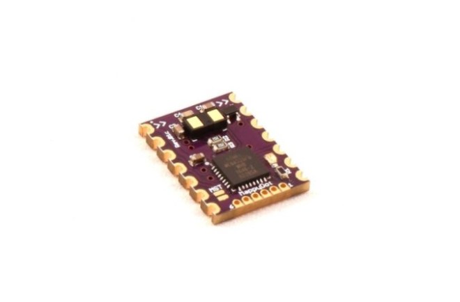
MappyDot Plus, from Tindie seller SensorDots, is a micro LiDAR solution that uses the VL53L1X time-of-flight sensor from STMicroelectronics, along with an onboard controller to provide a significant amount of features from one component.
Each MappyDot+ is able to provide distance measurements, in millimeters, up to 4 meters at a non-interpolated rate up to 100Hz. The field of view is programmable from 15 to 27 degrees without additional optics.
If you chain multiple MappyDots or SensorDot boards together, you can gather multi-dimensional data about an area, similar to radar, without reducing the sampling rate. The sensor also performs low pass filtering on the motion data to offer the clearest possible picture of the environment around it.
The pulses from MappyDot+ are used for a variety of functions. Drones can utilize them to avoid collisions in mid-flight, or harness the data to optimize landings. You can even equip the sensor to doors and have them open automatically.
Each MappyDot Plus ships with the latest firmware, but new features are constantly added. You can find the latest firmware version on the Github repository. You can also chain MappyDot Plus to other SensorDots boards (a breakout board for use with MappyDot Plus) on the same bus.
